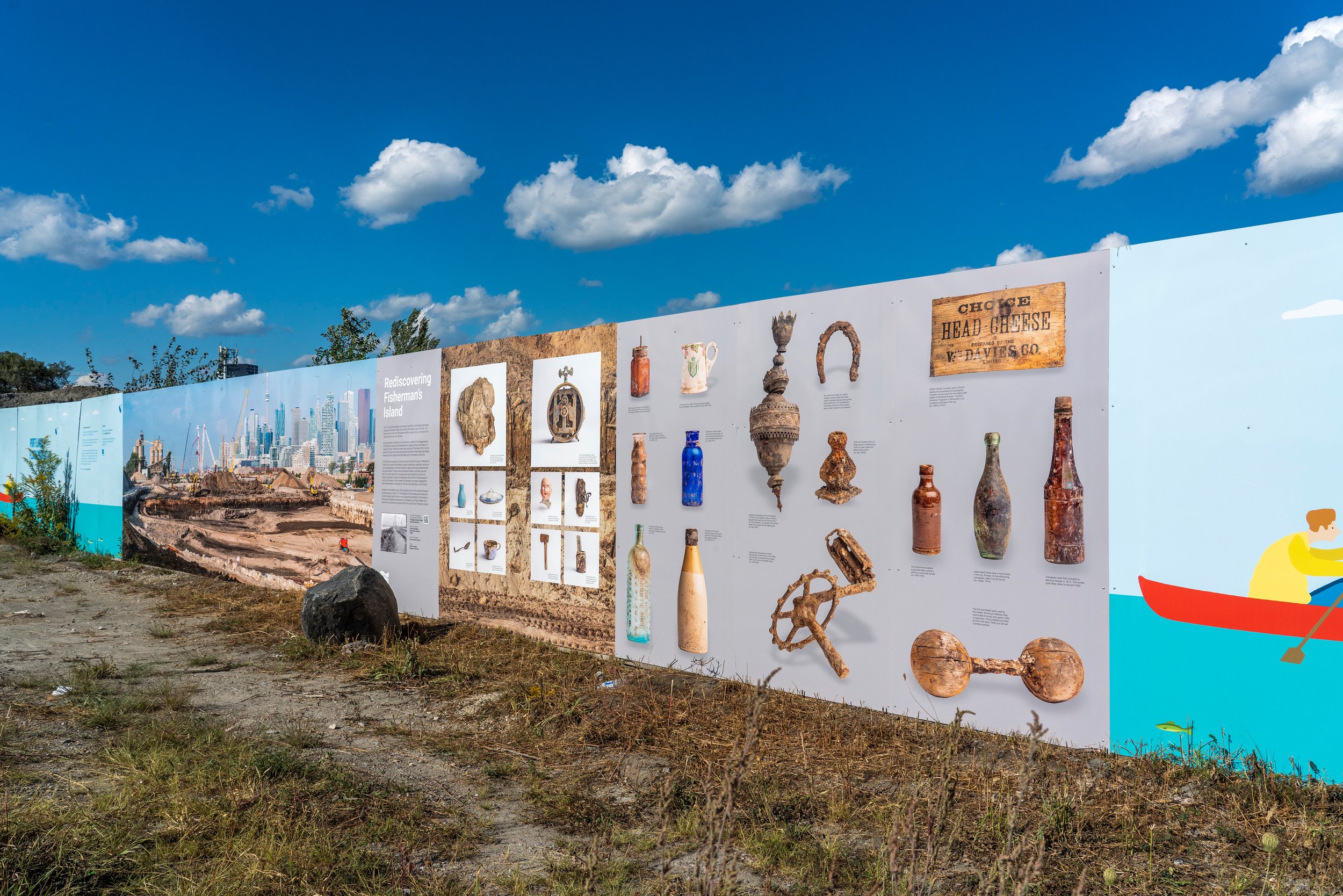
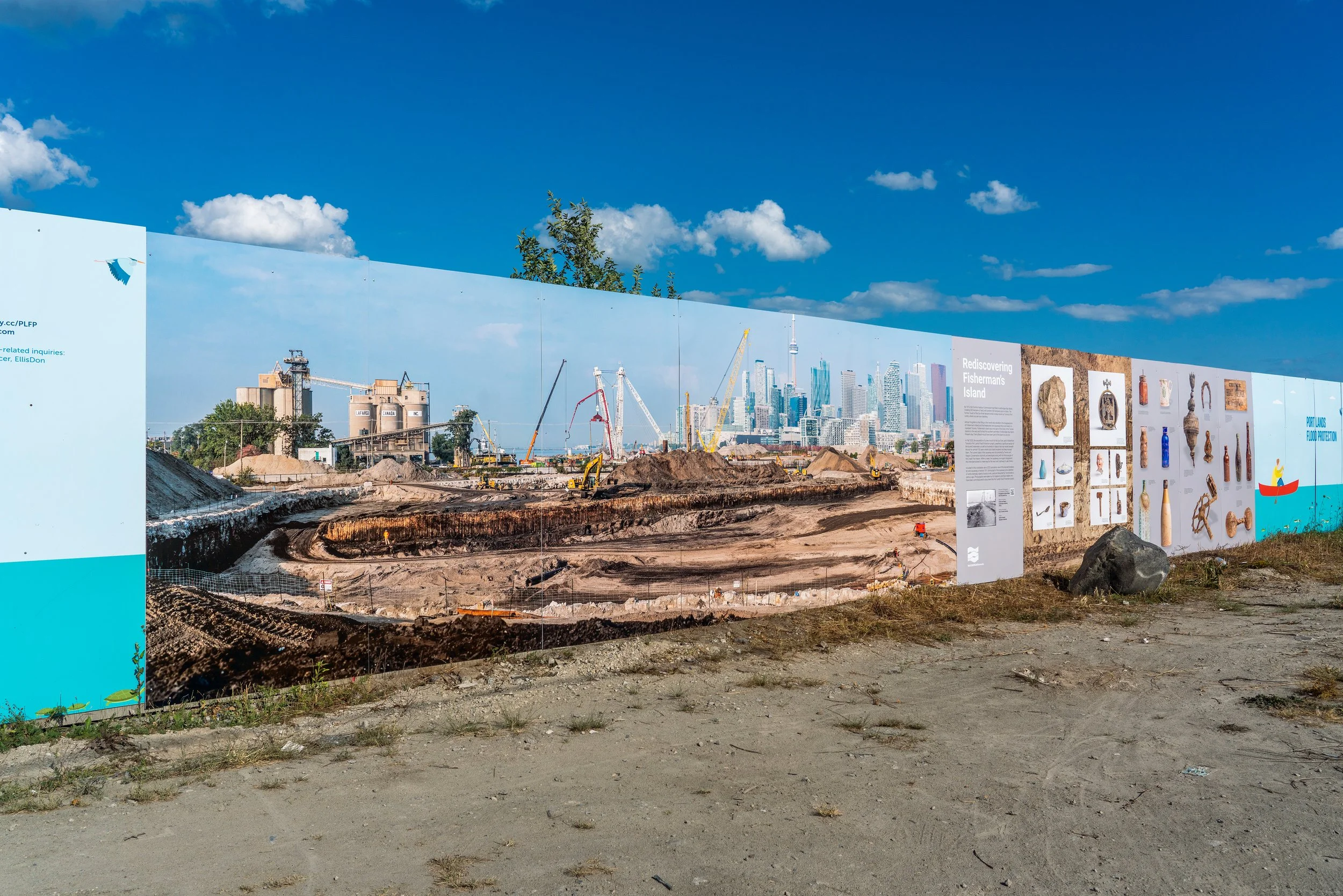
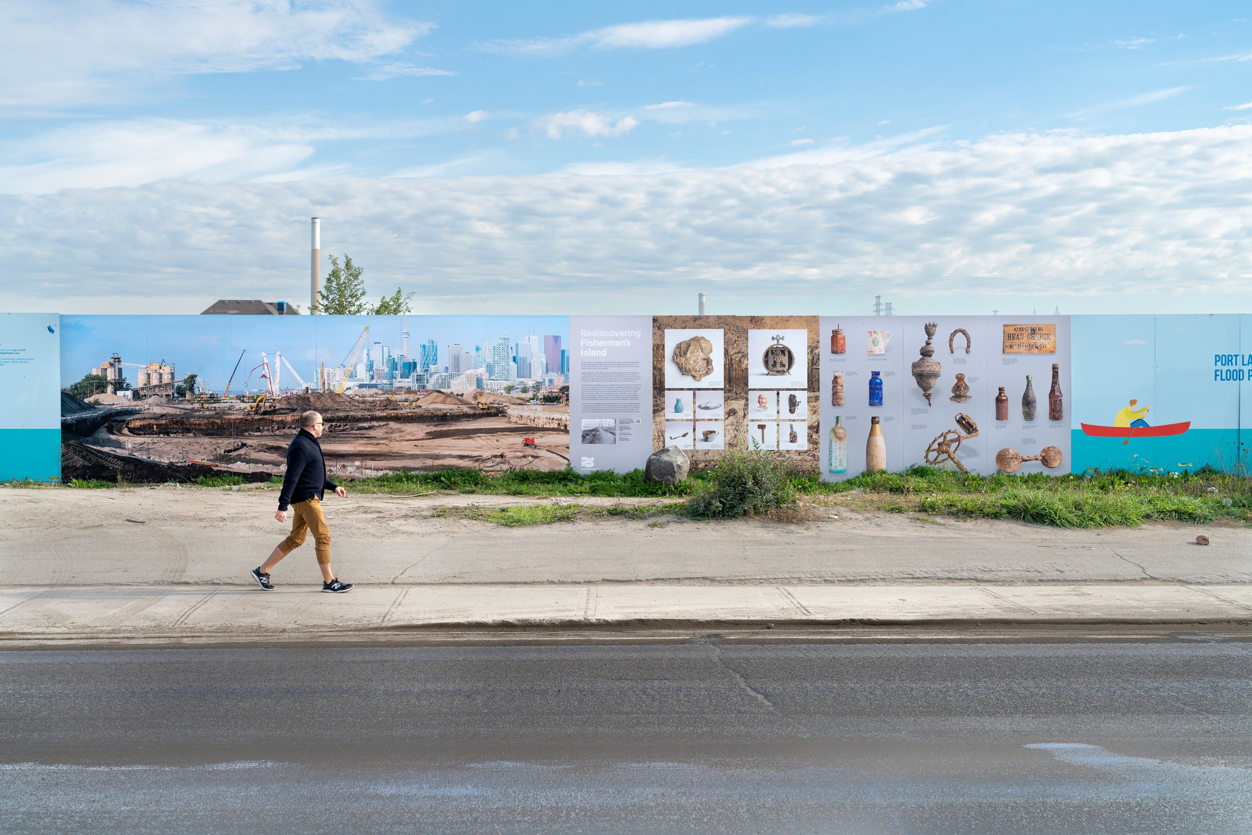
REDISCOVERING FISHERMAN’S ISLAND
Ryan Walker / Vid Ingelevics. Toronto Port Lands, Cherry St (43.644559, -79.351546), Toronto, CAN. (09/01/2021 - 09/01/2022)
On-site Installation Statement
By 1912, the Toronto Harbour Commission had filled Ashbridges Bay Marsh, creating 200 hectares of land, with another 200 hectares soon to follow. The former mouth of the Don River became what is today known as the Toronto Port Lands, and is where you are standing now.
Almost forgotten is that the filling in of the marsh also resulted in the disappearance of Fisherman’s Island and the breakwater and causeway that once linked it to mainland Toronto. Fisherman’s Island was once part of the chain of the Toronto Islands to the east and formed the southern perimeter of Ashbridges Bay Marsh. Present-day Cherry Beach would have been part of the island at one time.
In fall 2020, the excavation of a new mouth for the Don River as part of Waterfront Toronto’s Port Lands Flood Protection project unearthed a significant section of the buried breakwater, as we; as hundreds of objects that had resided beneath the soil for almost 100 years, where local Island residents had likely dumped them. The current state of the causeway was documented by Toronto and Region Conservation Authority archaeologists along with the Mississauga's of the Credit First Nation. Within a week, the causeway once again disappeared, this time demolished to make way for the new rivers pathway to Lake Ontario.
Included in this installation are a 2020 panoramic view of the exposed breakwater and causeway taken by Vid Ingelevics and Ryan Walker as part of their commissioned documentation of the Port Lands Flood Protection project, a historic 1911 photograph of the causeway, and a selection of some of the everyday objects found on site, used and discarded by Torontonians a century ago.